
Dale City ZIP Code Coverage
Prince William County identifies 22193 as the ZIP most directly associated with Dale City, listing it as Woodbridge/Dale City in its February 2020 ZIP reference. That is a starting point, not a city-limit line. The research did not establish a complete street-by-street CDP-to-postal crosswalk, nor did it establish that every nearby County ZIP serves the Dale City CDP. Confirm each address with USPS before attaching a ZIP to a parcel or record.
| ZIP | County reference area | Postal label | Research note |
|---|---|---|---|
| 22193 | Woodbridge / Dale City | Confirm the exact address through USPS | The County's most direct Dale City association; it is not a CDP boundary. |
County material also lists 22191 for Woodbridge and 22192 for Woodbridge, Lake Ridge, and Prince William among the County's other full or partial ZIPs. Those county-wide references do not prove that a given Dale City street belongs to either code. A postal result should be saved with its date because postal and subdivision geography do not use the same borders.
Note: Treat 22193 as a postal-search starting point, then retain the address wording returned by USPS and the County system.
Dale City ZIP Code USPS Fields
The official USPS ZIP Code Lookup standardizes mailing geography. It offers a By Address route, a By City and State route, and a Cities by ZIP route. USPS expressly warns that a ZIP result does not confirm that a person or company is at an address. Use it to verify mailing syntax before searching County records, not to infer occupancy or build a name list.
| USPS search route | Fields documented in research | Required field noted |
|---|---|---|
| By Address | Company, Street Address, Apt/Suite, City, State, ZIP | Street Address; Company and Apt/Suite are optional |
| By City and State | City, State | City and State |
| Cities by ZIP | ZIP | ZIP |
USPS includes Find and Look Up Another ZIP controls. Enter the physical Dale City street address as precisely as it is known, including an apartment or suite when relevant. If older local material uses Dale City while USPS returns Woodbridge, preserve both terms in the research note rather than forcing one label into every source.
Open the official USPS address and ZIP lookup to check the current postal wording.
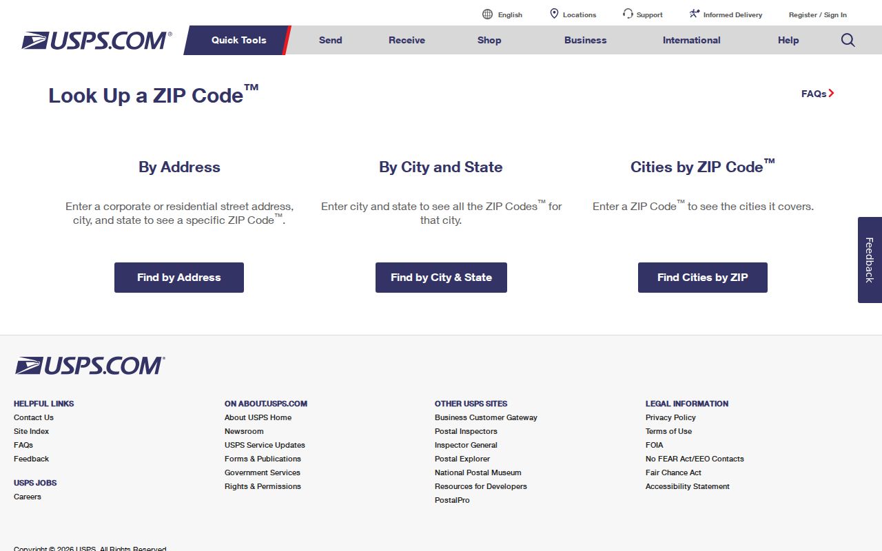
The form supports address validation. It does not supply a household roster or validate who receives mail at the address.
Find Dale City Records by ZIP Code
A ZIP code directory is best used as an organizing layer around a verified address. The reviewed research did not capture a public Prince William County tool that returns a complete resident result set from a ZIP filter. Do not substitute a broad ZIP search for a documented address search. Instead, move from postal verification to the address and GPIN fields that County systems actually expose.
- Run the exact mailing address through USPS and save the returned city, state, ZIP, and date.
- Enter the address in County Mapper and record the street wording and GPIN shown for the parcel.
- Compare that GPIN or address with the assessment portal for the parcel's owner, sale data, legal description, and assessed improvements.
- Use the recorded-document and permit channels for the same parcel when the question concerns a deed, plat, or project history.
- Keep postal results separate from ownership and occupancy evidence, then verify any conflict with the responsible office.
The Virginia voter information portal serves an individual status inquiry only after its identity and search flow. Public registration lists have statutory limits and protected-address rules, so they are not a ZIP-wide Dale City roster. Once a ZIP has narrowed the area to a specific street, use the Dale City street directory for the address, GPIN, deed, and parcel workflow.
Dale City ZIP Code and CDP Borders
Dale City is a Census-designated place, not an incorporated city. Prince William County governs the relevant parcel, tax, planning, court, election, and public-works records. That is why a searcher should expect County and Woodbridge labels in forms and results rather than a Dale City municipal office. ZIP boundaries, CDP boundaries, and subdivision names are separate systems, and none should be used as a substitute for the other.
The County's ZIP map and list are useful reference tools, but the research did not locate a definitive plain-text boundary and street crosswalk for the CDP. A parcel near a community edge can have a postal label that does not match the name used in neighborhood conversation. Retain the record's actual locality, then search both Dale City and Woodbridge when a name, street, or directory entry fails to appear under one form.
Boundary check. A ZIP code tells USPS how to route mail. It does not establish a Dale City city limit, a County record jurisdiction, or an occupant's identity.
Dale City ZIP Code Parcel Bridge
For County research, the GPIN is often more stable than the ZIP code. County Mapper supports a partial or full ten-digit GPIN, street number, partial street name, street type, and a multi-unit-property filter. At a close map scale, the user can identify the parcel, view the address and GPIN, select a basemap, and turn on layers such as land records, land development, public services, utilities, contours, and aerial imagery.
Carry the GPIN into the assessment record and Parcel History Tree. The tree can show parent and child parcel lineage when a lot split or combination makes an older land description hard to match. Parcel lines are approximate and are not a legal description. A ZIP code may help group research notes, but a GPIN and recorded instrument are better keys for matching the same land across County systems.
Dale City ZIP Code Permit Searches
Development Services provides a second address route through its public ePortal. The County says construction permits, land permits, plans, inspections, and hearings can be searched without an account. Permit searching accepts an address, permit number, or project name, while plan searching accepts an address or plan type. The reviewed instructions show result fields for plan number, applied date, type, completion date, expiration date, status, main parcel, project name, address, and description.
Start with the USPS-standardized address, then compare the ePortal result to the GPIN and subdivision or phase information. A Dale City permit can relate to a prior owner, project contact, or a particular building action. It does not establish who lives at the location. Some plans and documents may require authenticated or in-person access, so a result screen is not the last available access channel.
Note: Save a permit or plan number and its dates because one address can have several unrelated project records.
Dale City ZIP Code Geography in Numbers
Postal research should stay grounded in the community's actual geographic scale. The Census QuickFacts profile identifies Dale City as a CDP and reports a 2020 population of 72,088, land area of 14.24 square miles, and density of 5,062.4 persons per square mile. Those are aggregate geography figures. They do not identify a person, prove that a household has a particular feature, or turn a postal zone into a resident list.
Review the Census QuickFacts profile for Dale City CDP for the source and its comparison framework.
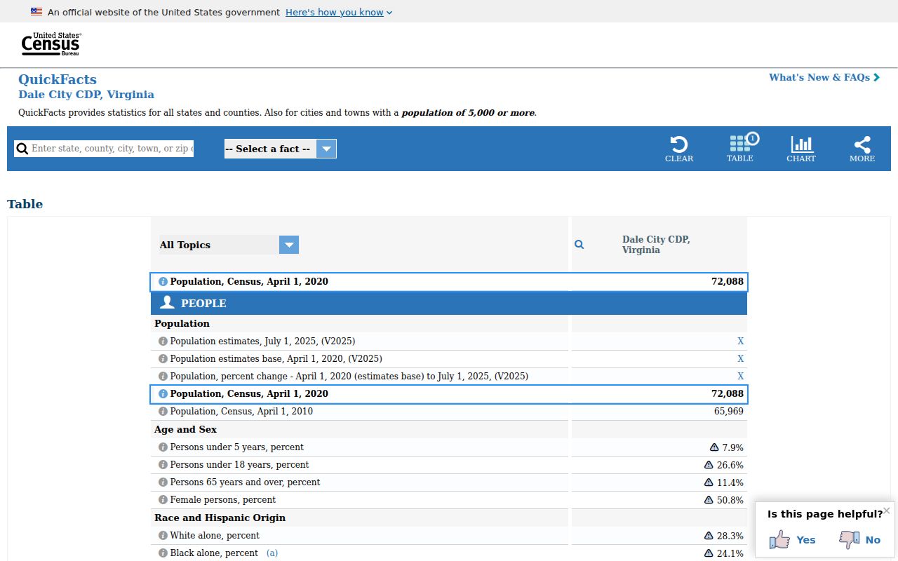
The Census profile describes the CDP as a whole. It is useful context for boundaries and scale, not a matching tool for a specific postal address.
Dale City ZIP Code History
Dale City's postal ambiguity makes sense in its development history. County history says the planned community opened June 19, 1965 with twelve model homes, after a 1964 rezoning, and the first family moved in later in 1965. Earlier land records can therefore use tract, farm, subdivision, Woodbridge, or nearby-community wording instead of a familiar modern postal label. Search the original wording alongside the standardized USPS result.
By July 1968, County history estimated 8,170 residents and 2,070 households. Those numbers explain the rapid buildout context, but they do not attach a particular name to a ZIP or parcel. The County's historical aerial imagery and plats are better tools for examining development phases than a postal search alone.
Dale City ZIP Code Access Routes
Online access starts with USPS, County Mapper, the assessment portal, ePortal, and the Circuit Clerk's land-record search. When the online result is unclear, Real Estate Assessments is the practical in-person and phone route for parcel questions: 4379 Ridgewood Center Drive, Suite 203, Woodbridge, 703-792-6780. The Circuit Clerk in Manassas handles recorded land documents at 9311 Lee Avenue and 703-792-6015. Ask the custodian about copies and current procedures before relying on a search result.
Prince William County FOIA accepts reasonably specific requests by mail, fax, email, phone, or in person, although it does not require an agency to create a new record or perform custom analysis. For historic postal labels, directories, newspapers, microforms, and local context, RELIC at Central Library and Dale City Neighborhood Library provide library routes; Historic Prince William holds maps and local collections. These channels can clarify an older address when a postal lookup alone cannot.
Dale City ZIP Code Terms
These postal terms prevent a valid mailing result from being overstated as a boundary or person record.
- ZIP code
- A USPS routing code for mail delivery, not a municipal boundary or a resident list.
- ZIP+4
- An added four-digit delivery segment used to refine a base ZIP code for a particular address or delivery point.
- PO-box ZIP
- A ZIP used for post-office-box delivery rather than a general street-delivery area.
- Unique ZIP
- A ZIP assigned to a single organization or delivery arrangement, where USPS uses that designation.
- Carrier route
- A mail-delivery grouping within a ZIP area; it is not a legal neighborhood boundary.
Keep the source date beside each postal result. A careful Dale City ZIP code directory preserves the difference between mailing geography, a CDP, and a County parcel record.